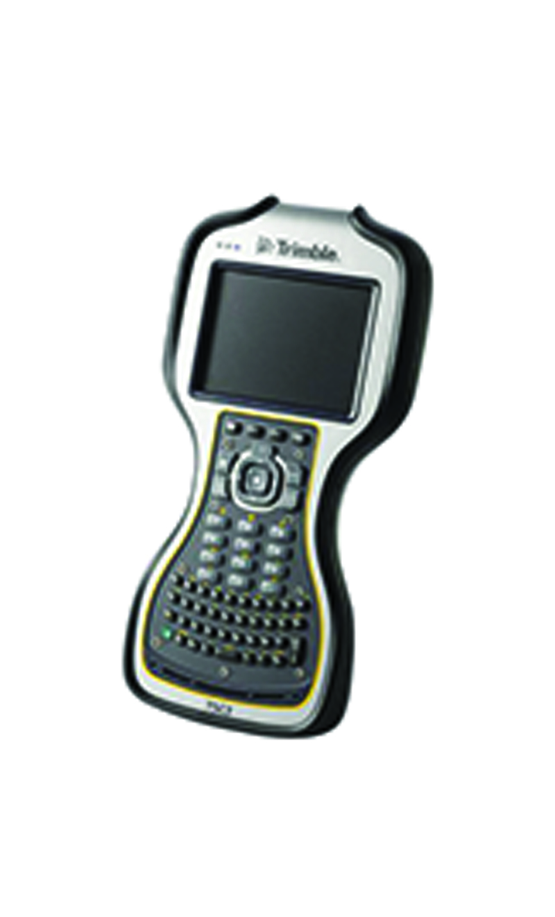
TSC3 Controller

  • Large, bright, high-resolution screen makes instrument control easy
  • Optimized for Trimble Access field software
  • Fully-integrated camera, GPS navigation, and communications
  • Improved collaboration and control through constant connectivity

R10 GNSS system

  • Cutting-edge Trimble HD-GNSS processing engine
  • Precise position capture with Trimble SurePoint technology
  • New Trimble xFill technology provides RTK coverage during connection outages
  • Advanced satellite tracking with Trimble 360 receiver technology
  • Sleek ergonomic design for easier handling

V10 Imaging rover

  • 12 calibrated cameras capture 60 MP panorama for full site visualization
  • Generate Survey, GIS or mapping accuracy positions from images
  • Rapid data collection with one-button capture of panoramas
  • Familiar, easy-to-use workflows in Trimble Access field software

450L and 450H radios

  • Easy setup and configuration... even in the field
  • The latest Trimble radio technology for optimal performance
  • Super-rugged housing for robust reliability

Business Center Software

  • Trimble Business Center is a highly automated desktop application for processing and managing optical, GNSS, and imaging data . With unique capabilities, such as GNSS data processing

Trimble R8s GNSS Receiver

  • One configurable receiver that is scalable for future needs
  • Available in post-processing, base only, rover only, or base & rover configurations
  • Advanced satellite tracking with Trimble 360 receiver technology
  • Includes Trimble Maxwell 6 chips with 440 channels
  • Simple integration with Trimble S-Series Total Stations and the V10 Imaging Rover
  • Intuitive Trimble Access Field Software and Trimble Business Center Office Software
  • Trimble DL Android app for collecting static GNSS raw data for post-processing

Trimble R2 GNSS Receiver

  • Professional solution for survey-grade workflows
  • Submeter to centimeter level accuracies
  • Fast to setup, easy-to-use, keeping you productive and focused on your work
  • Supports multiple satellite constellations and correction sources for accurate data at any location
  • Trimble Maxwell 6 chip with 220 channels and leading GNSS technology maximizes data quality
  • Easily collect data by pairing with a Trimble handheld controller

Trimble Geo7X

  • Easy-to-use feature coding
  • Feature-rich graphical COGO routines for calculating points and features
  • Graphical staking of points, lines, arcs, and alignments from active maps
  • Detachable Geo 7X rangefinder accessory - simply point and shoot to get the position
  • Integrated Surveying technology combines optical, scanning, and GNSS data plus images in the same job
  • Trimble VISION enabled sensor control
  • Real-time data sharing between field and office – move files, provide updates, deliver completed projects